Introduction: The New Perspective of the Environmental Engineer
Environmental engineering is a special branch of engineering focused on the design, construction, and management of systems and structures that protect and improve the natural environment. Environmental engineers nowadays are addressing some of the most concerning global challenges of our time, including understanding and mitigating the impacts of climate change, ensuring proper waste management, controlling air pollution, developing advanced water treatment solutions, etc. In an era of rapid environmental changes and rising ecological concerns, environmental engineers require tools that can deliver accurate, real-time information. Traditional ground-based monitoring methods, while valuable, often face significant limitations in terms of spatial coverage, frequency of data collection, and cost-effectiveness for large or remote areas.
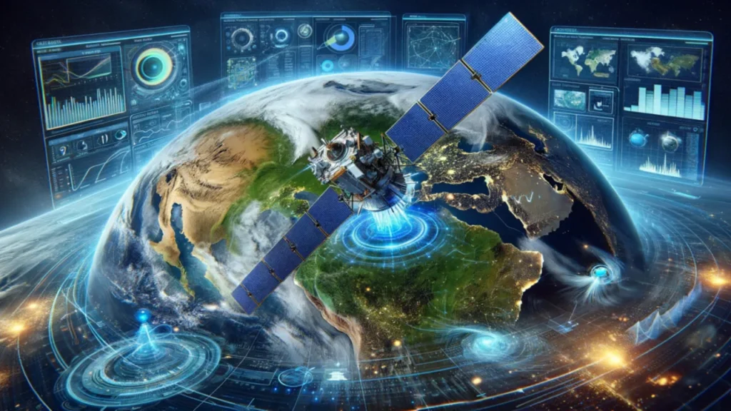
This creates a substantial data gap, making it challenging to get a comprehensive and continuous understanding of environmental conditions across wide regions. Satellite monitoring and Earth observation technology have emerged as a revolutionary solution. Satellites offer an unparalleled “synoptic view” of the Earth’s surface, allowing the identification of pollution sources, the tracking of dispersion patterns, and the assessment of mitigation strategy effectiveness across wide regions. This capability goes beyond the limited and often scattered insights offered by traditional ground-based systems. It provides a broader, more detailed view that helps us better understand environmental changes as they happen. By filling critical data gaps, it transforms how we approach environmental decision-making, moving us from reactive responses and cleanups to proactive planning, smarter management, and prevention.
How Satellite Remote Sensing Works
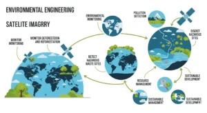
Remote sensing is the fundamental principle behind satellite imagery, getting information about an object or area from a distance without physical contact. Every object and surface on Earth possess a unique “spectral fingerprint”. Orbiting satellites carry specialized sensors that detect and record the electromagnetic energy reflected or emitted from Earth’s surface and atmosphere. This means that different materials, whether water, soil, or plants, emit or reflect energy in different quantities across various electromagnetic bands. By identifying and differentiating these unique energy returns, researchers can identify different Earth features and even specific rock and mineral types.
Satellite remote sensing systems are broadly categorized into two types based on how they acquire energy:
- Passive Sensors: These systems depend on natural energy sources, mainly sunlight, that are reflected or emitted. Most passive systems utilized in remote sensing applications operate within the visible, infrared, thermal infrared, and microwave bands of the electromagnetic spectrum. They are useful in measuring many physical characteristics, including land and sea surface temperature, vegetation properties, and cloud characteristics. But one of the limitations of these is that without sunlight or the blockage of receiving reflected light, it results in data discontinuation.
- Active Sensors: In comparison to passive systems, active sensors emit their own energy, such as light or radio signals, and then detect the signals that return from the object or surface. Premier examples of this technology include LiDAR (Light Detection and Ranging), which precisely measures distance using light, and Radar (Radio Detection and Ranging), which employs radio signals for ranging. Active sensors offer great advantages over passive sensors: they can operate independently of sunlight and often possess the capability to penetrate clouds, dense vegetation, and even dry soil to some extent. This makes them invaluable for all-weather, day-night environmental monitoring.
The electromagnetic spectrum covers the full range of electromagnetic radiation frequencies, extending from low-frequency radio waves to high-frequency gamma rays. A clear understanding of how different regions of this spectrum interact with Earth’s surface is necessary for effective remote sensing. For example, the visible light spectrum, detectable by the human eye, is used for capturing color imagery and analyzing surface features like vegetation, water bodies, and urban areas. Infrared and thermal radiation are used for temperature mapping, wildfire detection, and agricultural water stress assessment. Microwaves, the core of radar remote sensing, can penetrate clouds and vegetation, enabling applications such as soil moisture estimation, ocean surface monitoring, and terrain mapping using Synthetic Aperture Radar (SAR).
Applications: Satellite Imagery in Action
Monitoring Pollution:
Satellite monitoring and Earth observation technology are transforming pollution assessment by providing accurate, real-time information at an unprecedented scale.
- Air Quality Monitoring: Advanced satellites are capable of measuring atmospheric concentrations of hazardous pollutants such as nitrogen dioxide (NO₂), carbon monoxide (CO), sulfur dioxide (SO₂), and particulate matter (PM2.5).6 This data helps in identifying pollution hotspots, tracking regional and global air quality changes, and identifying the emission sources and their dispersion patterns.
- Water Quality Monitoring: Remote sensing and satellite imagery are extensively used in identifying harmful algal bloom (HAB) outbreaks, measuring sediment load, and detecting industrial pollution in water bodies with significant precision. Multispectral and hyperspectral imaging are specifically used to track key water quality parameters like chlorophyll concentration and suspended solids. The integration of artificial intelligence (AI) with water resource management enables real-time monitoring of rivers, lakes, and reservoirs, their nature, and their change.
Tracking Land Use and Deforestation:
Satellite imagery is being used widely in monitoring the dynamic changes occurring on the Earth’s surface, particularly land cover and land use patterns.
- Mapping Urban Sprawl and Infrastructure Development: Satellite imaging can be used in mapping and tracking changes in land use, infrastructure development, and urban growth. High-resolution imagery helps in evaluating the environmental effects of urban expansion, identifying high-density areas, and the study of spatial trends. With the integration of AI, this also can be used to look into the urbanization trend and its future.
- Detecting Deforestation and Forest Degradation: Satellite data is widely being used for detecting changes in forest cover, identifying illegal logging activities, and tracking the effectiveness of various conservation efforts. When combined with Geographic Information Systems (GIS) technology, remote sensing offers a comprehensive understanding of how forest cover has changed over time.
Managing Natural Resources:
Satellite imagery plays a crucial role in the assessment and analysis of natural resources, covering agriculture, forestry, and coastal management.
- Precision Agriculture: Satellite imagery delivers accurate insights into crop health, water stress, and pest infestation, which are essential for optimizing irrigation schedules, determining fertilizer needs, and identifying pest risk zones. By using indices such as the Normalized Difference Vegetation Index (NDVI) and the Enhanced Vegetation Index (EVI), satellites provide valuable information to engineers and farmers, resulting in effective use and application of water, herbicides and other resources. Integrated with AI and deep machine learning, satellite data allows for efficient monitoring of crops.
- Forestry and Ecosystem Health: Satellite imagery is being used to monitor changes in vegetation, soil, geology, and land cover, which is critical for protecting natural resources and analyzing the impact of both natural changes and policy implementations. High-resolution satellite photography is widely used in forestry management to track the health of forests over time.
Responding to Natural Disasters:
Satellite imagery provides rapid and accurate information during natural disasters, which is crucial for effective emergency response and mitigation efforts.
- Wildfire and Flood Mapping: Satellites are capable of detecting wildfires and monitoring their spread, delivering timely and accurate data on their location and severity. This information significantly helps emergency responders target their efforts more effectively. For floods, the rapid delivery of satellite imagery enables clear waterline identification, facilitates evacuation zone modelling, and supports effective resource allocation during emergencies.
- Landslide Monitoring and Emergency Response: Satellite imagery can identify areas at high risk of landslides and mudslides. Synthetic Aperture Radar (SAR) technology, especially Interferometric SAR (InSAR), is employed to detect minute ground subsidence, deformations, and elevation changes. This capability is critical for monitoring the structural integrity of vital infrastructure, such as dams and bridges, and for understanding geological processes that could make areas vulnerable to landslides.
Addressing Climate Change:
Environmental monitoring plays a critical and increasingly central role in tracking the multifaceted impacts of climate change.
- Greenhouse Gas Monitoring: Satellite-based monitoring of greenhouse gases, using hyperspectral and thermal bands, provides accurate measurements of carbon dioxide (CO₂) and methane emissions from industrial sources.
Temperature, Precipitation, and Sea-Level Rise Tracking: Satellites offer a historical perspective on global and local changes in temperature and rainfall patterns, providing valuable information that can be used in agricultural planning and water reservoir management. Thermal infrared sensors on satellites can measure Earth’s surface temperature over time. Accurate measurements of sea surface height help in understanding and predicting coastal risks, which is vital for urban planners and environmental agencies and for managing agricultural lands in vulnerable coastal zones.
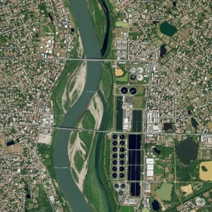
Figure: Satellite image of a River Channel
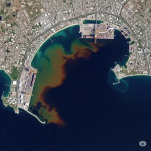
Figure: Monitoring Coastal water pollution
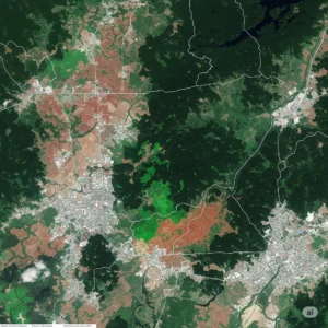
Figure: Land use & land cover map over a region
Limitations
Though satellite imaging and analysis is changing the way of engineering in different sectors, like other technological advancements, this also comes with some limitations.
Technical Complexities:
Cloud Cover and Atmospheric Interference: Satellite Imagery requires cloud-free conditions for accurate data acquisition. Atmospheric components, such as water vapour and carbon dioxide, can absorb or reflect specific wavelengths, thereby affecting the quality and accuracy of the collected data. Also, shadows and distortions caused by the sun’s angle can complicate image interpretation.
Data Interpretation Challenges: Satellite images, particularly those from Synthetic Aperture Radar (SAR) systems, can be challenging to interpret. This complexity arises from factors such as speckle noise, the ways in which radar waves interact with different surface materials, and the sensitivity of SAR images to surface properties like roughness and moisture content
Data Management: The Big Data Challenge: The increasing volume and complexity of geospatial data, characterized by its sheer size, high frequency (temporal resolution), heterogeneity (diverse data types and formats), and high dimensionality (multispectral or hyperspectral channels), demands robust systems and specialized expertise for effective utilization of these data.
Cost and Expertise Requirements: Using satellite imagery can be costly sometimes. Though satellite data is being made more accessible to people nowadays, it still requires advanced technological tools and special expertise in this field to properly utilize the data and acquire the required insight from it.
Scale Issues: Effectively scaling remotely sensed information across different resolutions and extents can be difficult. This challenge can complicate data interpretation and the application of models, as information relevant at one scale may not directly translate or be sufficiently detailed at another, hindering the integration of localized field observations with broader satellite perspectives.
Conclusion:
Satellite imagery has revolutionized environmental engineering by offering a powerful, wide-reaching view of our planet. It allows us to monitor air and water quality, detect deforestation, manage natural resources, and respond rapidly to natural disasters—all from a consistent, global, and non-intrusive perspective. This technology has moved environmental monitoring beyond fragmented, local observations to data-driven strategies that cover vast regions.
The future of satellite imagery in this field is incredibly bright, driven by rapid advances in sensor technology, the integration of AI and machine learning, and the growing availability of open data. Together, these developments promise sharper images, more frequent updates, and smarter analysis—enabling deeper understanding and more precise responses to environmental challenges.

